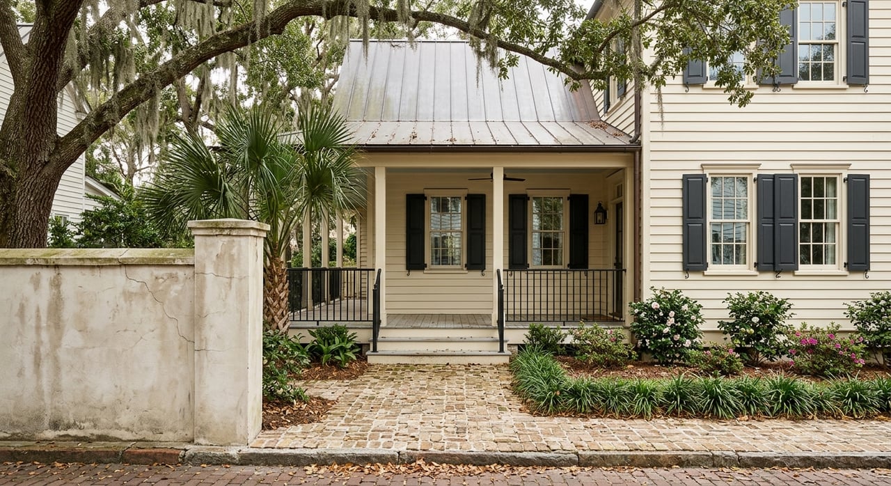
Planning a pool, dock, or renovation on Isle of Palms? One small line can change everything. The South Carolina OCRM “critical line” is a mapped shoreline boundary that affects setbacks, permits, and where you can build. If you understand it now, you can avoid costly surprises later. This guide explains what the line is, why it matters on Isle of Palms, and how to verify it before you buy. Let’s dive in.
What is the OCRM critical line?
South Carolina’s Office of Ocean and Coastal Resource Management (OCRM), a program within SCDHEC, maps and manages coastal regulatory lines along the shoreline. The “critical line” is an OCRM‑mapped boundary used to identify areas that need special coastal protection and review. It is an administrative line that helps determine where certain structures or activities may be limited or require permits.
The critical line is different from other terms you may hear. The mean high water line is a tidal boundary used in title and riparian rights questions, and it is not the same as the OCRM line. FEMA flood zones are separate maps, and you can be affected by both FEMA rules and the OCRM critical line at the same time. Local setback and baseline rules may also measure from the OCRM line.
OCRM uses aerial imagery, field inspections, historical data, and defined criteria to draw and update the line. Shorelines move with storms and natural processes, but the official line changes only when OCRM updates its maps or makes a site‑specific determination.
Why it matters on Isle of Palms
On Isle of Palms, the OCRM critical line influences the buildable area of a lot. It affects where you can place your primary structure, accessory structures, pools, and septic systems. Work near or seaward of the line often requires state review, and some uses are limited by setback rules.
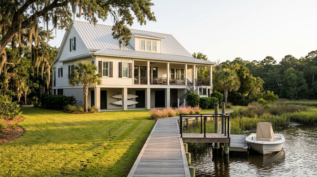
Docks, piers, and boat lifts typically require state review and often federal permits as well. The location of the OCRM line and tidal boundaries can affect the permit type, mitigation, and how you access the water. If you plan to renovate or add to an existing home, crossing substantial improvement thresholds can trigger stronger elevation, foundation, and permitting standards, especially near regulated areas.
Insurance, financing, and resale can also be impacted. Buyers sometimes assume the entire lot is usable, then find out that OCRM setbacks reduce the practical footprint. Planning with the line in mind helps you protect your investment and your timeline.
Pools, docks, and renovations
Pools close to the OCRM line are often restricted or require larger setbacks and specific design solutions. In some cases, an in‑ground pool seaward of regulated lines can be denied or need mitigation. If you want a pool, it is smart to confirm the line early and test potential layouts.
Docks and water‑dependent structures usually trigger both state and federal review. You should expect permitting steps that account for the OCRM line, mean high water, navigability, and riparian access. Experienced local professionals can help you evaluate feasibility and likely conditions.
Renovations and additions may be allowed, but the rules are different near the OCRM line and in mapped flood zones. If your project meets a substantial improvement threshold, you may have to elevate, modify foundations, or redesign. Factor this into your budget and calendar before you close.
Verify the critical line before you buy
You can verify the OCRM critical line and related constraints with a clear, step‑by‑step process.
Key documents to gather
- OCRM official map extract or web map view for the parcel
- Current certified boundary survey by a South Carolina licensed land surveyor
- Survey or coastal determination that overlays the OCRM critical line on the site
- Local records from Isle of Palms Planning and Building, plus Charleston County GIS and permit history
- Prior OCRM permits for docks, dune work, seawalls, or shoreline stabilization
- FEMA Flood Insurance Rate Map panel and any elevation certificate data
- Title search and recorded easements, covenants, and local setbacks
Recommended order of steps
- Ask the seller or listing agent for the latest certified survey, prior permits, and any OCRM files as part of your due diligence. Confirm dates and scope.
- Obtain the OCRM map extract for the parcel and note the map date. Treat it as a regulatory baseline until a field determination changes it.
- Hire a coastal‑experienced land surveyor to prepare a current boundary survey. Request that the OCRM critical line be shown or that the survey is suitable for a coastal overlay. If the map is unclear, ask about a site‑specific determination through OCRM procedures.
- If you plan a dock or significant seaward work, consult a coastal engineer or marine contractor with Isle of Palms permit experience to evaluate feasibility and likely conditions.
- Contact Isle of Palms Planning and Building to review local ordinances, dune management, any beach renourishment history, and local setbacks that may layer onto state rules.
- Review FEMA maps and consider an elevation certificate if you plan to renovate or rebuild. Understand how Base Flood Elevation interacts with your design.
Permits, timelines, and risk
Waterfront work on Isle of Palms often involves multiple approvals. Common reviews include SCDHEC/OCRM coastal permits for regulated areas and dune or beach work, U.S. Army Corps of Engineers permits for in‑water structures, Isle of Palms local permits and zoning approvals, Charleston County building permits, and wetlands review when applicable.
Timelines vary. OCRM reviews can take weeks to months depending on scope and completeness. Corps permits can add weeks to months, especially for individual permits. Field determinations, engineering reports, and mitigation plans extend time, and seasonal work windows may apply for environmental reasons.
Budget for surveys and coastal assessments, engineering design and application fees, and potential mitigation or restoration requirements. Also plan for redesign costs if constraints limit your original concept. Early verification helps you avoid stop‑and‑start delays.
Buyer pitfalls to avoid
- Assuming the entire lot is buildable without checking OCRM mapping and local setbacks
- Relying on aerials or seller statements to locate the line instead of official sources
- Underestimating time and cost for docks or seaward improvements
- Skipping a title review for access easements or old OCRM permits that limit new work
Due‑diligence checklist
- Obtain seller‑provided surveys, permits, and disclosures as a contract contingency
- Order a current, certified boundary survey tailored for a coastal overlay
- Request the OCRM map extract and verify the map date or any pending updates
- Confirm local rules with Isle of Palms Planning and Building, and review permit history
- Engage a coastal engineer or marine contractor to vet docks and shoreline work
- Review FEMA FIRMs and consider an elevation certificate for renovation planning
- Budget time and money for state and federal permits when work is near the shoreline
- Add contract contingencies for satisfactory OCRM and local permit feasibility, and for a site‑specific determination if needed
Offer and design strategy
If you plan a pool, dock, or major addition, bring your surveyor and coastal professional into the conversation before you write the offer. Ask for enough due‑diligence time to complete mapping confirmation and feasibility checks. Price and design your project around the buildable area that remains after OCRM and local setbacks.
For resale and long‑term value, keep documentation organized. A clear paper trail of surveys, determinations, and permits can reassure future buyers and lenders. That clarity can support stronger pricing and smoother closings.
Work with a local team
Barrier islands like Isle of Palms reward early, expert planning. The OCRM critical line is central to pools, docks, and structural changes, and it interacts with both flood maps and local ordinances. When you build your team early, you gain time, options, and leverage.
Ready to evaluate a specific property or lot plan? Start with the map extract and a current survey, then layer in coastal and local reviews. For a discreet, white‑glove strategy tailored to your goals, request a Private Consultation with Oliver Caminos.
FAQs
What is South Carolina’s OCRM critical line?
- It is an official shoreline boundary mapped by SCDHEC’s Office of Ocean and Coastal Resource Management that helps regulate where certain coastal activities and structures are allowed or require permits.
How does the OCRM line affect a pool on Isle of Palms?
- Pools near or seaward of the line are often restricted, may need larger setbacks or special designs, and can be denied or conditioned during permitting.
Do I need permits for a dock or pier?
- Most docks and water‑dependent structures require state review and often a U.S. Army Corps of Engineers permit, with requirements shaped by the OCRM line and tidal boundaries.
Is the OCRM map the final word on my lot?
- The map is the regulatory baseline, but OCRM can refine it through a site‑specific field determination; until then, permits rely on the official mapped line.
Will flood zones replace the need to check the OCRM line?
- No. FEMA flood zones are separate from the OCRM critical line, and a property can be affected by both sets of rules at the same time.
What steps verify the line before closing?
- Obtain the OCRM map extract, order a current certified survey, request an overlay or field determination if needed, review local ordinances, and check any prior OCRM permits.
Should I rely on the seller’s old survey?
- Only rely on a current, certified survey prepared for you and checked against OCRM mapping, since shorelines and official maps can change over time.
How long do coastal permits take on Isle of Palms?
- OCRM reviews can take weeks to months, and Corps permits can add more time; field determinations and engineering reports may extend the timeline.